Once again, we are keeping an eye on a tropical organism that, while not directly threatening Florida, will dictate weather conditions through the middle of next week.
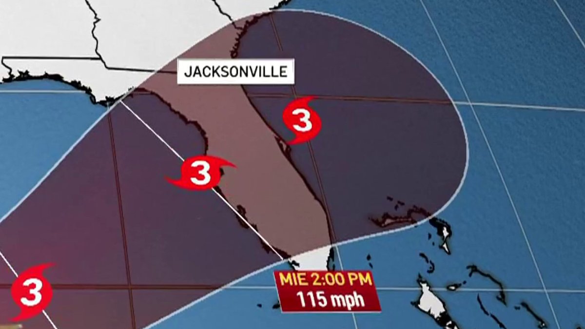
Starting Tuesday night and continuing throughout the day Wednesday, southeastern Florida could feel the indirect effects of Tropical Storm Milton, which would be approaching Florida’s west coast by this date as a hurricane. great intensity.
Let’s review the impacts we could see in Southeast Florida:
Rain
This is the main risk factor for southeastern Florida, as accumulations of up to 8 inches are expected, but not everything is precisely related to Milton.
A weak low pressure system has formed over our area that has an associated weak cold front.
This weather pattern favors the formation of rain and storms, and that is why throughout the weekend and even on Monday we will see deteriorating weather conditions.
On Tuesday we will have a break from the rain and it will be on Wednesday when the rain returns, now related to Milton. Also arriving on saturated ground due to the abundant rainfall over the weekend.
Regardless of which weather system the rain we will receive is due to, the important thing is to be informed and follow the instructions of the authorities, avoiding driving through flooded sectors, and taking measures on your property if you live in these more vulnerable areas.
We will be under a flood watch until Thursday morning.
Wind
During this period of time we could feel strong winds, especially in gusts. The probability of reporting sustained tropical storm winds (> 39 mph) is 18% for Miami, 36% for Fort Lauderdale and 42% for West Palm Beach, with that percentage increasing as we move north. That is, closer to the center of circulation.
Severe storms and tornadoes
It is not ruled out from Tuesday night and during Wednesday due to storms that may form in the spiral bands of the tropical cyclone.